


Cedar Twp. Voting District, Martin County, Minnesota
About
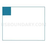
Outline

Summary
| Unique Area Identifier | 603082 |
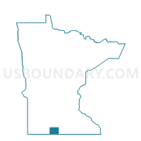
| Name | Cedar Twp. Voting District |
| County | Martin County |
| State | Minnesota |
| Area (square miles) | 35.77 |
| Land Area (square miles) | 34.71 |
| Water Area (square miles) | 1.06 |
| % of Land Area | 97.04 |
| % of Water Area | 2.96 |
| Latitude of the Internal Point | 43.79783950 |
| Longtitude of the Internal Point | -94.80440840 |
Maps

Graphs
Select a template below for downloading or customizing gragh for Cedar Twp. Voting District, Martin County, Minnesota


Neighbors
Neighoring Voting District (by Name) Neighboring Voting District on the Map
- Elm Creek Twp. Voting District, Martin County, MN
- Enterprise Twp. Voting District, Jackson County, MN
- Fox Lake Twp. Voting District, Martin County, MN
- Galena Twp. Voting District, Martin County, MN
- Kimball Twp. Voting District, Jackson County, MN
- Long Lake Twp. Voting District, Watonwan County, MN
- Odin Twp. Voting District, Watonwan County, MN
Top 10 Neighboring County Subdivision (by Population) Neighboring County Subdivision on the Map
- Long Lake township, Watonwan County, MN (338)
- Fox Lake township, Martin County, MN (256)
- Galena township, Martin County, MN (248)
- Cedar township, Martin County, MN (223)
- Elm Creek township, Martin County, MN (188)
- Enterprise township, Jackson County, MN (187)
- Odin township, Watonwan County, MN (170)
- Kimball township, Jackson County, MN (129)
Top 10 Neighboring Unified School District (by Population) Neighboring Unified School District on the Map
- Jackson County Central School District, MN (7,797)
- Martin County West Public School District, MN (4,520)
- Mountain Lake Public Schools, MN (3,118)
- Butterfield Public School District, MN (1,201)
Top 10 Neighboring State Legislative District Lower Chamber (by Population) Neighboring State Legislative District Lower Chamber on the Map
Top 10 Neighboring State Legislative District Upper Chamber (by Population) Neighboring State Legislative District Upper Chamber on the Map
Top 10 Neighboring 111th Congressional District (by Population) Neighboring 111th Congressional District on the Map
Top 10 Neighboring Census Tract (by Population) Neighboring Census Tract on the Map
- Census Tract 7901, Martin County, MN (3,108)
- Census Tract 9503, Watonwan County, MN (2,977)
- Census Tract 7902, Martin County, MN (2,587)
- Census Tract 4801, Jackson County, MN (2,276)
Top 10 Neighboring 5-Digit ZIP Code Tabulation Area (by Population) Neighboring 5-Digit ZIP Code Tabulation Area on the Map
- 56171, MN (1,821)
- 56176, MN (1,137)
- 56120, MN (1,121)
- 56111, MN (420)
- 56162, MN (285)
- 56160, MN (214)